Mission-Ready Drone Services,
Delivered End-to-End
Scandron provides advanced drone services designed to support high-altitude operations, critical infrastructure, and complex missions. From inspections and surveys to surveillance and data acquistion, our services combine certified platforms, skilled operators, and actionable insights, so you can execute with speed, safety, and precision.
Confined Space Inspection
Scandron provides professional confined space drone inspection services for tanks, tunnels, boilers, pipelines, and industrial chambers. Using high-resolution aerial imaging and real-time data capture, we eliminate human risk, reduce shutdown time, and deliver safe, cost-effective inspection solutions for hard-to-access environments.
Drone Flying Service
Our drone flying and rental service deploys certified UAV platforms for testing, aerial surveys, pilot projects, mapping, and custom operational requirements. With trained operators and compliant drone systems, we provide flexible drone support without the need for in-house infrastructure investment.
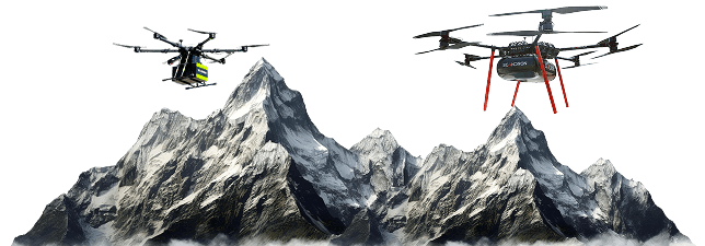
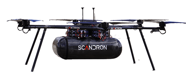
LDaaS Logistics Drone As A Service
Scandron’s Logistics Drone as a Service (LDaaS) delivers reliable base-to-base aerial logistics for remote and high-altitude regions. Designed for defence resupply, disaster response, and critical supply transport, our heavy-lift logistics drones reduce dependency on ground transport while ensuring fast and efficient delivery.
Drone Visual & Thermal Inspection Service
Our drone visual and thermal inspection services combine high-resolution optical cameras with advanced thermal imaging to detect structural defects, heat anomalies, and equipment faults. Ideal for infrastructure, energy, and industrial facilities, this service improves safety and supports preventive maintenance strategies.
Drone UTM (Ultrasonic Thickness Measurement) Service
Scandron’s drone-based ultrasonic thickness measurement (UTM) service enables accurate corrosion detection and structural integrity assessment at height. Designed for refineries, power plants, and heavy industry, our aerial UTM solution reduces scaffolding requirements while delivering precise material thickness data efficiently.
Ground Penetrating Radar (GPR)
Acquire subsurface data efficiently using drone-mounted GPR systems. Detect utilities, voids, and underground structures through soil, rock, ice, and shallow water, especially in challenging terrains.
GIS, Survey & Volumetric Analysis
Capture high-precision geospatial data for land surveys, terrain mapping, and volumetric calculations. Support informed planning and decision-making with accurate, scalable aerial data.
Bathymetry
Perform accurate waterbody mapping and depth analysis for rivers, reservoirs, ports, and coastal zones. A safer, faster alternative to traditional bathymetric surveys in hazardous aquatic environments.
Building Inspection
Inspect facades, rooftops, towers, and structural elements using drone-based imaging. Identify defects, wear, and maintenance needs quickly while minimizing risk and operational disruption.
Agriculture & Forests
Enable crop monitoring, vegetation analysis, and forest assessment using aerial data and multispectral insights. Support sustainable agriculture, yield optimisation, and environmental monitoring at scale.
Ready to Deploy the
Right Drone Solutions?
From high-altitude logistics and precision inspections to surveillance, surveys, and advanced sensor-based operations, Scandron delivers drone services engineered for real-world performance. Backed by proven platforms, skilled operators, and indigenous R&D, we help you execute missions with speed, safety, and reliability, no matter how challenging the environment.